

Northwest Regional Airport Terrace-Kitimat
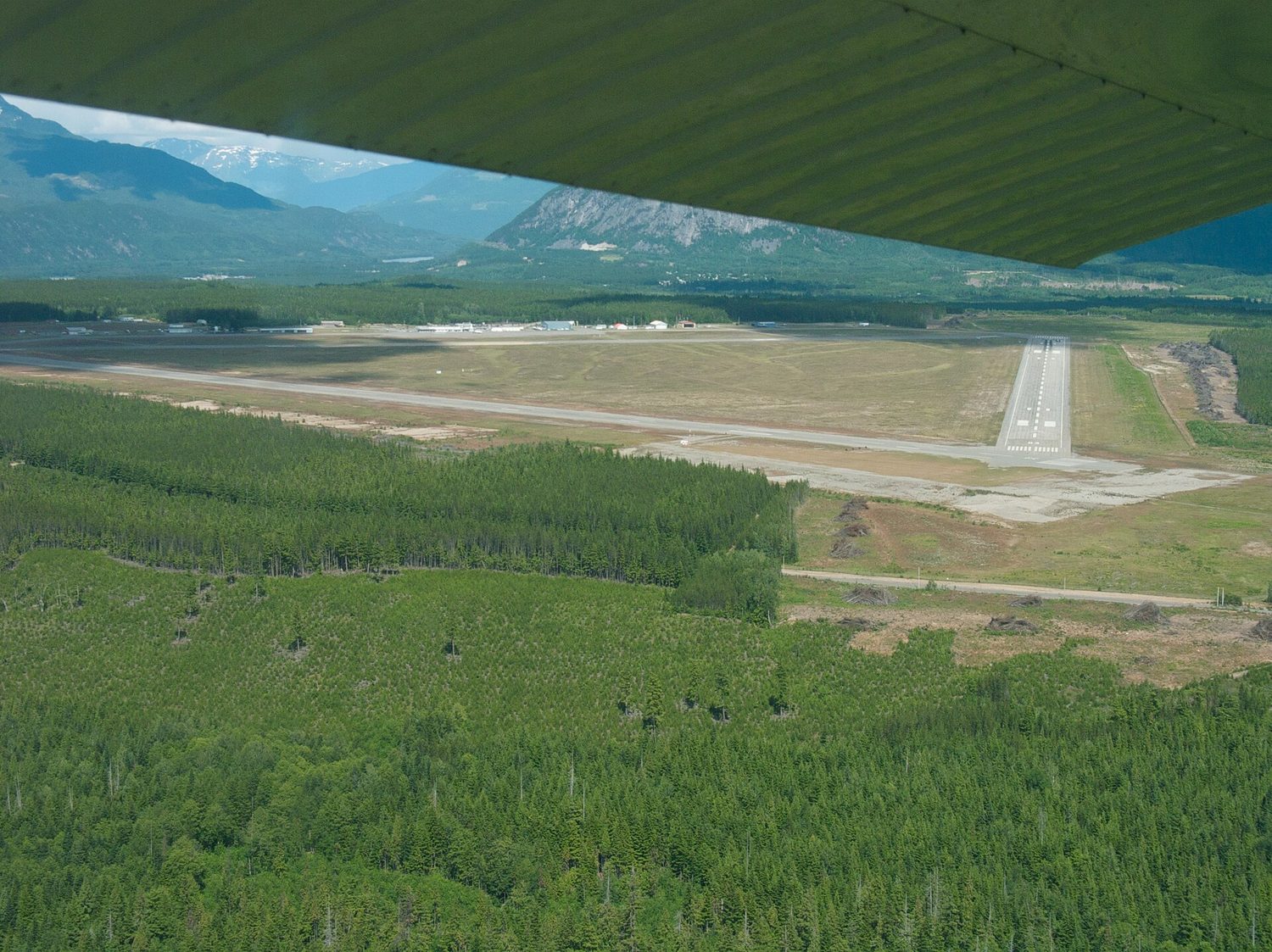
Northwest Regional Airport Terrace-Kitimat
Northwest Regional Airport Terrace-Kitimat, (IATA: YXT, ICAO: CYXT), is a regional airport serving northwestern British Columbia, Canada, including Terrace, Thornhill, Kitimat, and the Nass River Valley. Located is located 3 nautical miles (5.6 km; 3.5 mi) south of Terrace (about 10 km (6.2 mi) south of downtown), the airport connects the region to major Canadian cities through passenger, cargo, and charter services. YXT is managed by the Terrace-Kitimat Airport Society, a non-profit organization responsible for its operations and strategic development.
Location

54.468°N, 128.576°O · 217 m s. n. m. (713 ft)
General data
Runways · 2
Lengths and surfaces from the public OurAirports register; open runways only.
Radio frequencies · 3
Area control (center)
Flight information
Reference frequencies for enthusiasts, from OurAirports (community database, public domain), checked on Oct 16, 2026. They may be outdated or incomplete and do not replace the AIP or current charts: not for navigation. In Europe the published frequency may be an 8.33 kHz channel (e.g., 118.505 for 118.500). In MHz.
History
World War II origins
YXT was originally constructed in 1943 as a Royal Canadian Air Force (RCAF) airbase during World War II. It formed part of Canada's Pacific defence strategy against potential Japanese threats. The facility hosted fighter and bomber squadrons, including the Hawker Hurricanes of No. 135 Squadron and Ventura bombers of No. 149 Squadron.
Construction challenges, such as harsh weather and limited resources, delayed the base’s operational readiness. By 1944, as the perceived threat diminished, the airbase shifted to a support role, and in 1945, RCAF decommissioned the base.
Post-war civilian use
Transferred to the Department of Transport in 1946, the airfield transitioned to civilian use. In 1947, it received its first civilian airport license, though it saw limited activity until the 1950s. The industrial development of Kitimat and the construction of the aluminum smelter brought increased demand for regional air transport, leading to infrastructure upgrades, including night-flight lighting systems in 1956.
Modernization and local management
In 1999, the airport was transferred to the Terrace-Kitimat Airport Society under Canada’s National Airports Policy.
Airlines operating here · 4
Other airlines with direct routes
Airlines with current passenger routes from here, according to Wikipedia route tables cross-checked from both ends (October 2026).
Photo: https://www.flickr.com/people/sbeebe/ - Sam Beebe / Ecotrust · CC BY 2.0 · view original
Data from OurAirports (public domain) · destinations and airlines from Wikipedia route tables (CC BY-SA, 2026), unless another source is given · profile and photo from Wikidata/Wikimedia Commons (CC0 / CC) · summary and history from Wikipedia (CC BY-SA).
Cite
To cite this page in academic work, an article or Wikipedia, choose the style and copy the reference. The access date is today.
This page was last updated on October 15, 2026
APA
Vuelopedia. (2026, October 15). Northwest Regional Airport Terrace-Kitimat (YXT). Retrieved October 23, 2026, from https://vuelopedia.org/en/airport/YXT
MLA
“Northwest Regional Airport Terrace-Kitimat (YXT).” Vuelopedia, Fundación Poderia, 15 Oct. 2026, vuelopedia.org/en/airport/YXT. Accessed 23 Oct. 2026.
Chicago
Vuelopedia. “Northwest Regional Airport Terrace-Kitimat (YXT).” Fundación Poderia. Last modified October 15, 2026. https://vuelopedia.org/en/airport/YXT.
Harvard
Vuelopedia (2026) Northwest Regional Airport Terrace-Kitimat (YXT). Available at: https://vuelopedia.org/en/airport/YXT (Accessed: 23 October 2026).
BibTeX
@misc{vuelopedia_en_airport_yxt,
  author       = {{Vuelopedia}},
  title        = {{Northwest Regional Airport Terrace-Kitimat (YXT)}},
  publisher    = {Fundación Poderia},
  year         = {2026},
  date         = {2026-10-15},
  url          = {https://vuelopedia.org/en/airport/YXT},
  howpublished = {\url{https://vuelopedia.org/en/airport/YXT}},
  urldate      = {2026-10-23},
  note         = {Accessed 2026-10-23}
}Wikipedia
{{cite web |url=https://vuelopedia.org/en/airport/YXT |title=Northwest Regional Airport Terrace-Kitimat (YXT) |website=Vuelopedia |publisher=Fundación Poderia |date=2026-10-15 |access-date=2026-10-23 |language=en}}