

Dien Bien Phu Airport
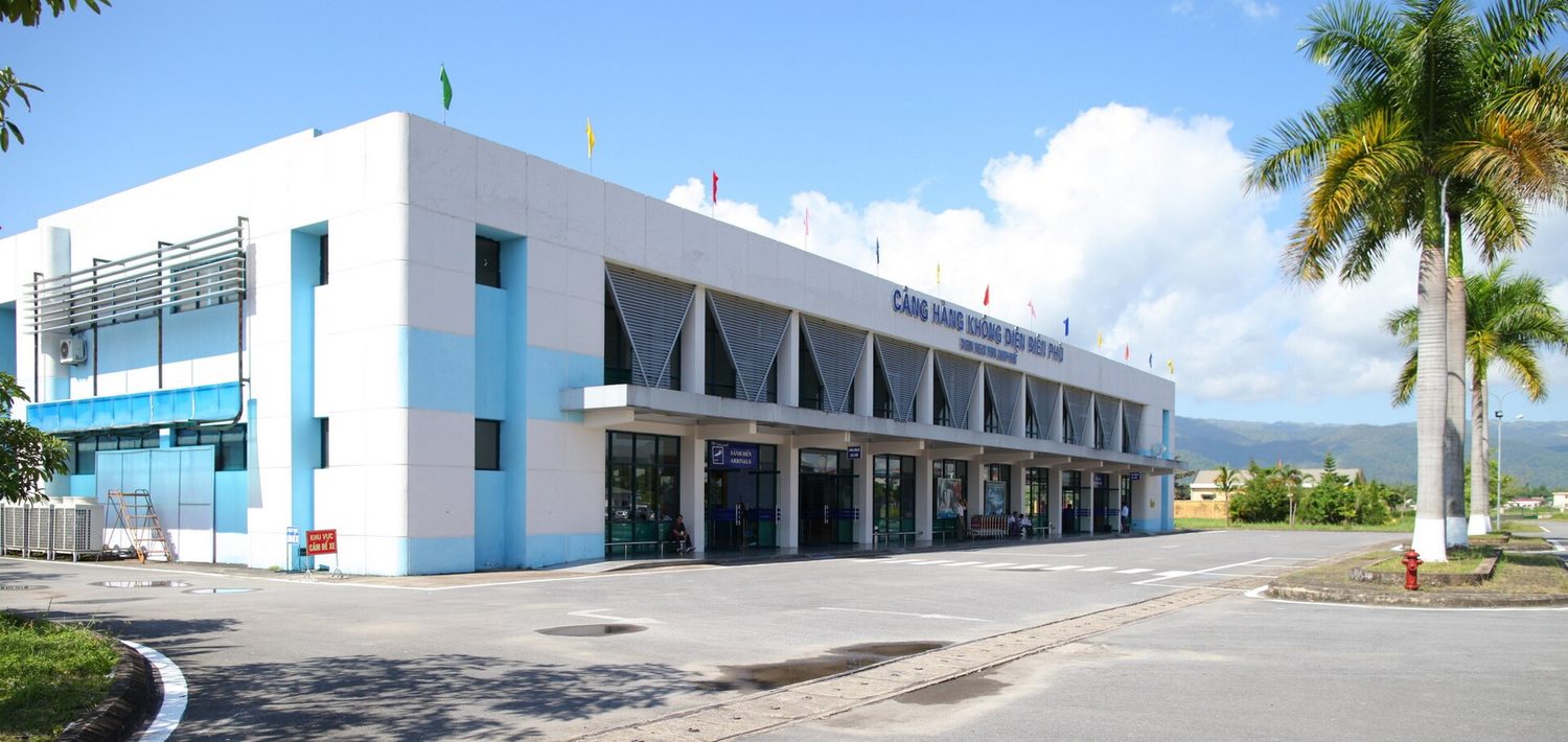
Dien Bien Phu Airport
Dien Bien Airport (IATA: DIN, ICAO: VVDB) is located at ?i?n Biên Ph? in Vietnam.
Location

21.397°N, 103.008°E · 491 m s. n. m. (1.611 ft)
General data
Runways · 1
Lengths and surfaces from the public OurAirports register; open runways only.
Radio frequencies · 1
Tower
Reference frequencies for enthusiasts, from OurAirports (community database, public domain), checked on Oct 16, 2026. They may be outdated or incomplete and do not replace the AIP or current charts: not for navigation. In Europe the published frequency may be an 8.33 kHz channel (e.g., 118.505 for 118.500). In MHz.
History
Điện Biên Phủ Airport was established in 1954 as Mường Thanh Airfield. The main purpose of it is to serve the French HQ in Điện Biên Phủ at the time of the First Indochina War.
4 years after the French left Điện Biên Phủ, in 1958, commercial flights to the airport started, operated by the Air Force, but only for a while due to the low demand at the time. In 1984, along with the 30th Anniversary of the Battle of Dien Bien Phu, flights from Hanoi to Điện Biên Phủ resumed, operated by the Antonov An-24. 10 months later, in January 30, 1995, this route is once again suspended because of the runway needed to be repaired. After the repair, flight resumed, this time being operated by the ATR 72. In 2004, the airport's apron is extended to 12000 square meters, with 4 parking stands for ATR 72 aircraft.
Airlines operating here · 1
Other airlines with direct routes
Airlines with current passenger routes from here, according to Wikipedia route tables cross-checked from both ends (October 2026).
Photo: [Tycho] · CC BY-SA 3.0 · view original
Data from OurAirports (public domain) · destinations and airlines from Wikipedia route tables (CC BY-SA, 2026), unless another source is given · profile and photo from Wikidata/Wikimedia Commons (CC0 / CC) · summary and history from Wikipedia (CC BY-SA).
Cite
To cite this page in academic work, an article or Wikipedia, choose the style and copy the reference. The access date is today.
This page was last updated on October 15, 2026
APA
Vuelopedia. (2026, October 15). Dien Bien Phu Airport (DIN). Retrieved October 24, 2026, from https://vuelopedia.org/en/airport/DIN
MLA
“Dien Bien Phu Airport (DIN).” Vuelopedia, Fundación Poderia, 15 Oct. 2026, vuelopedia.org/en/airport/DIN. Accessed 24 Oct. 2026.
Chicago
Vuelopedia. “Dien Bien Phu Airport (DIN).” Fundación Poderia. Last modified October 15, 2026. https://vuelopedia.org/en/airport/DIN.
Harvard
Vuelopedia (2026) Dien Bien Phu Airport (DIN). Available at: https://vuelopedia.org/en/airport/DIN (Accessed: 24 October 2026).
BibTeX
@misc{vuelopedia_en_airport_din,
  author       = {{Vuelopedia}},
  title        = {{Dien Bien Phu Airport (DIN)}},
  publisher    = {Fundación Poderia},
  year         = {2026},
  date         = {2026-10-15},
  url          = {https://vuelopedia.org/en/airport/DIN},
  howpublished = {\url{https://vuelopedia.org/en/airport/DIN}},
  urldate      = {2026-10-24},
  note         = {Accessed 2026-10-24}
}Wikipedia
{{cite web |url=https://vuelopedia.org/en/airport/DIN |title=Dien Bien Phu Airport (DIN) |website=Vuelopedia |publisher=Fundación Poderia |date=2026-10-15 |access-date=2026-10-24 |language=en}}