

Bristol Airport
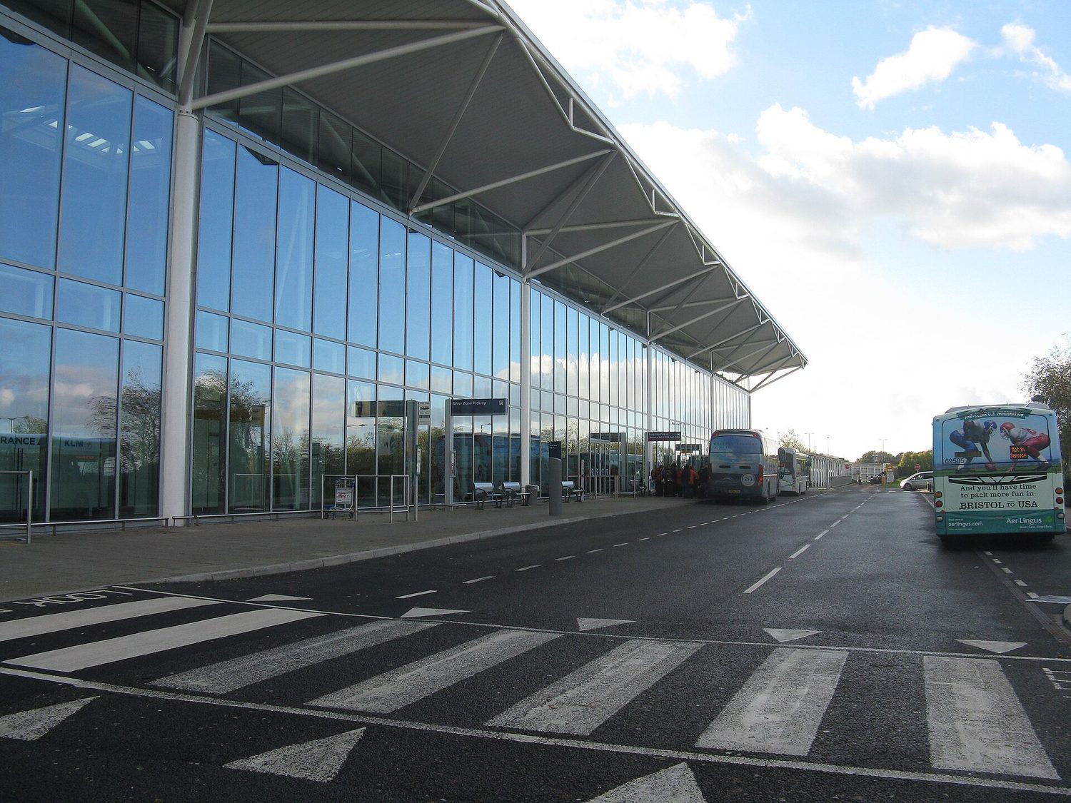
Bristol Airport
Bristol Airport (IATA: BRS, ICAO: EGGD) is an international airport serving the city of Bristol, England, and the surrounding area. Located at Lulsgate Bottom, on the northern slopes of the Mendip Hills, in North Somerset, it is 8 miles (13 kilometres) southwest of Bristol city centre. Built on the site of a former RAF airfield, it opened in 1957 as Bristol (Lulsgate) Airport, replacing Bristol (Whitchurch) Airport as Bristol's municipal airport. From 1997 to 2010, it was known as Bristol International Airport. In 1997, a majority shareholding in the airport was sold to FirstGroup, and then in 2001 the airport was sold to a joint venture of Macquarie Bank and others. In September 2014, Ontario Teachers' Pension Plan bought out Macquarie to become the sole owner. In November 2025, Macquarie Asset Management purchased 55% of the shares, with the remainder held by Australia's New South Wales Treasury Corporation ("TCorp"), the Australian Retirement Trust (“ART”) and StepStone In 2019, it was ranked the eighth busiest airport in the United Kingdom, handling over 8.9 million passengers, a 3% increase compared with 2018. In 2025, while maintaining its eighth position, it served 10.83 million passengers, accounting for 3.6% of all UK airport passengers. A passenger survey carried out in 2015 found that 32.5% of journeys using the airport started or ended in the city of Bristol, 9.6% in Gloucestershire, 24.5% in Somerset, 16.9% in Devon and 8.2% in Wiltshire.
Location

51.382°N, 2.716°O · 190 m s. n. m. (622 ft)
General data
Runways · 1
Lengths and surfaces from the public OurAirports register; open runways only.
Radio frequencies · 5 Official publication
Tower
Ground
ATIS (automatic information)
Approach
Frequencies from the official publication: UK AIP (NATS), AIRAC 01 OCT 2026, checked on Oct 16, 2026. They change with each amendment: not for navigation without checking the current AIP. See the official publication In MHz.
History
In 1927, a group of local businessmen raised £6,000 through public subscription to start the Bristol and Wessex Aeroplane Club, a flying club initially based at Filton Aerodrome. In 1929, Bristol Corporation took up the club's proposal to develop farmland located at Whitchurch, to the south of Bristol, into a municipal airport. On its opening by Prince George, Duke of Kent in 1930, Bristol (Whitchurch) Airport was the third civil airport in the United Kingdom. Passenger numbers grew to 4,000 by 1939. During World War II, Whitchurch was the main civil airport remaining operational. The newly formed British Overseas Airways Corporation (BOAC) was transferred to Whitchurch from Croydon Airport and Heston Airport. BOAC operated routes around the British Empire and to neutral nations. The Bristol–Lisbon route (Portugal was a neutral nation and had both British and German planes flying there) was operated by the Dutch airline KLM, under charter to BOAC. In September 1940, No. 10 Elementary Flying Training School RAF at RAF Weston-super-Mare established a Relief Landing Ground on 14 acres (5.7 ha) at Broadfield Down by the hamlet of Lulsgate Bottom, southwest of the city and north of Redhill village. Being high, at 600 ft (180 m), the site had a poor weather record during warm front conditions, when it was often covered in low cloud. However, when this occurred the alternative airfields at Filton and Cardiff were usually clear and operational; and as Lulsgate was clear when the low-lying airfields were obscured by radiation fog in calm weather, the landing ground provided a useful alternative. Few facilities were constructed although pillboxes, defensive anti-aircraft guns and later two Blister hangars were added. In late 1940, a Starfish site was set up south of the village of Downside and just west of the airfield. Its decoy fires attracted a large quantity of Luftwaffe high explosives and incendiaries on the nights of 16 March 3 and 4 April 1941 during the Bristol Blitz. In 1941, RAF Fighter Command planned to use the airfield for an experimental unit, and after requisitioning land from several adjacent farms, contracted George Wimpey and Company to begin work on 11 June 1941. However, its intended use soon changed into being a satellite airfield for the fighter squadrons based at RAF Colerne. Originally, the new airfield's name was to be RAF Broadfield Down. The airfield used a standard-issue three-runway layout resembling an A shape. The main, east–west runway was 3,891 ft (1,186 m) long, with a designated alignment of 28/10, and the others were 3,281 ft (1,000 m) aligned 21/03 and 3,294 ft (1,004 m) aligned 34/16. The first aircraft to land was a Luftwaffe Ju 88 at 06.20 on 24 July 1941. Returning from a raid, its crew had been deceived by the RAF electronic countermeasures radio beacon at Lympsham, which was re-radiating the signal from a Luftwaffe homing beacon at Brest, France. By 1942, there was no longer a need for an additional fighter airfield. With its name changed to RAF Lulsgate Bottom, the airfield was declared operational on 15 January 1942. The Miles Masters, Airspeed Oxfords and Hawker Hurricanes of No. 286 (AA Cooperation) Squadron became resident, with the role of providing realistic exercises for ground anti-aircraft defences. However, as the site lacked some basic facilities, No. 286 moved to RAF Zeals in May. From 1 June 1942, the airfield was under No. 23 Group of RAF Flying Training Command, and initially became a satellite airfield for No. 3 (Pilot) Advanced Flying Unit (3 (P)AFU), based at RAF South Cerney, flying Oxfords. In March 1943, No. 1540 Beam Approach Training Flight RAF (1540 BATF) was formed at Lulsgate, again flying Oxfords. On 27 September 1943, 3 (P)AFU left Lulsgate for RAF Southrop, and was replaced on 1 October 1943 by No. 3 Flying Instructors School (3 FIS), which was previously headquartered at RAF Hullavington. 3 FIS flew mostly Oxfords and some Masters.
Airlines operating here · 12
Airlines using it as a main base (hub)
Other airlines with direct routes
Airlines with current passenger routes from here, according to Wikipedia route tables cross-checked from both ends (October 2026).
Photo: M J Richardson · CC BY-SA 2.0 · view original
Data from OurAirports (public domain) · destinations and airlines from Wikipedia route tables (CC BY-SA, 2026), unless another source is given · profile and photo from Wikidata/Wikimedia Commons (CC0 / CC) · summary and history from Wikipedia (CC BY-SA).
Cite
To cite this page in academic work, an article or Wikipedia, choose the style and copy the reference. The access date is today.
This page was last updated on October 15, 2026
APA
Vuelopedia. (2026, October 15). Bristol Airport (BRS). Retrieved October 16, 2026, from https://vuelopedia.org/en/airport/BRS
MLA
“Bristol Airport (BRS).” Vuelopedia, Fundación Poderia, 15 Oct. 2026, vuelopedia.org/en/airport/BRS. Accessed 16 Oct. 2026.
Chicago
Vuelopedia. “Bristol Airport (BRS).” Fundación Poderia. Last modified October 15, 2026. https://vuelopedia.org/en/airport/BRS.
Harvard
Vuelopedia (2026) Bristol Airport (BRS). Available at: https://vuelopedia.org/en/airport/BRS (Accessed: 16 October 2026).
BibTeX
@misc{vuelopedia_en_airport_brs,
  author       = {{Vuelopedia}},
  title        = {{Bristol Airport (BRS)}},
  publisher    = {Fundación Poderia},
  year         = {2026},
  date         = {2026-10-15},
  url          = {https://vuelopedia.org/en/airport/BRS},
  howpublished = {\url{https://vuelopedia.org/en/airport/BRS}},
  urldate      = {2026-10-16},
  note         = {Accessed 2026-10-16}
}Wikipedia
{{cite web |url=https://vuelopedia.org/en/airport/BRS |title=Bristol Airport (BRS) |website=Vuelopedia |publisher=Fundación Poderia |date=2026-10-15 |access-date=2026-10-16 |language=en}}